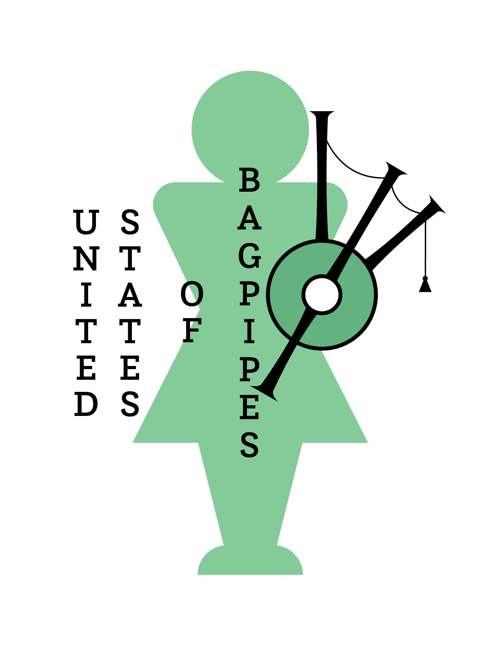
A Bagpiper's Guide to the US: Exploring Spatial and Gender Patterns in the Pipe Band Community
I have been playing bagpipes for more than ten years and I have often found that when I talk to non-piping friends about my experience playing in a pipe band, they are usually surprised that a pipe band has more than just bagpipers in it. Following countless conversations in the same vein and wanting to put numbers to demographic disparities I have noticed in the pipe band community over the past few years, I decided to create a visualization.
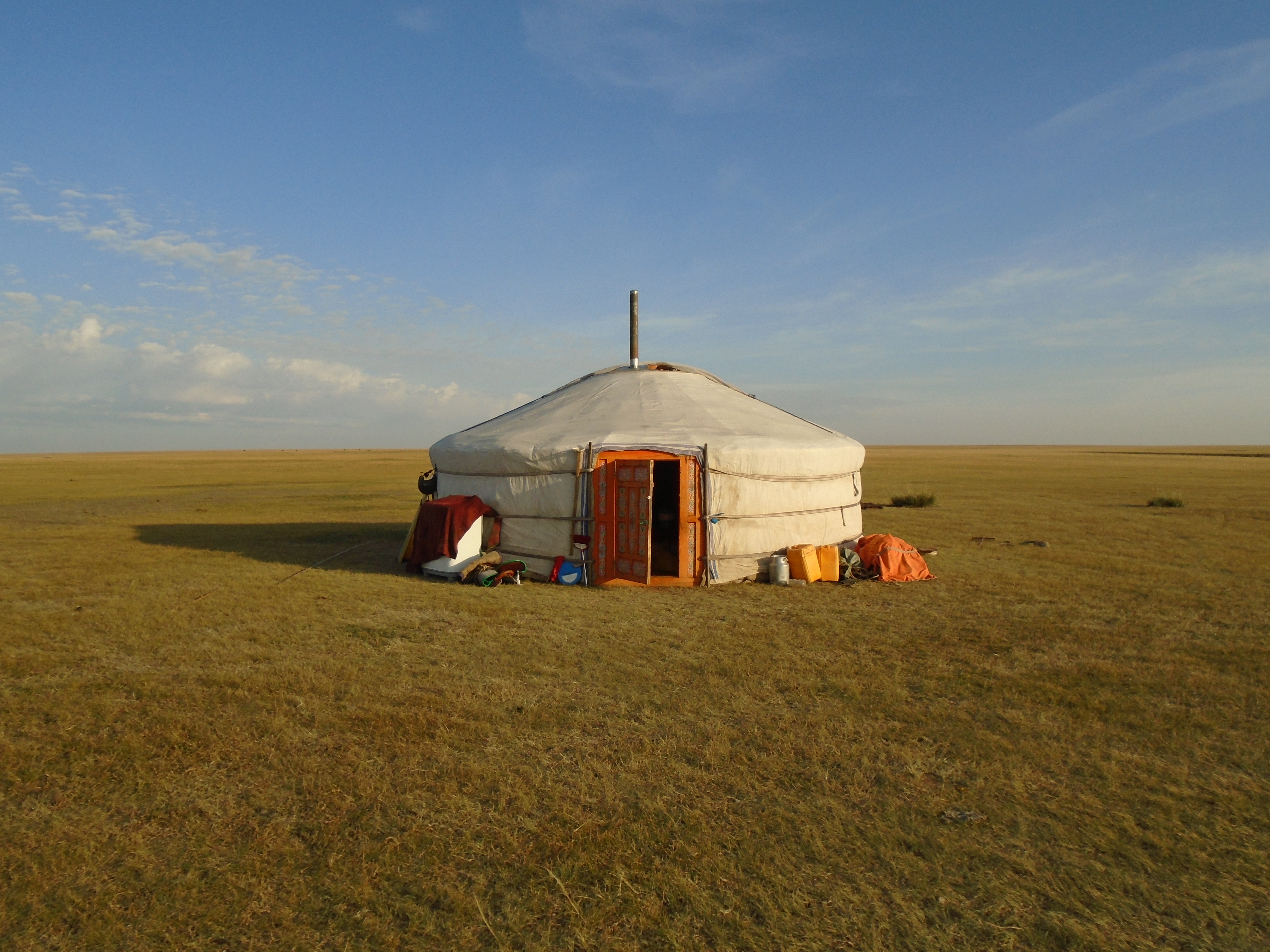
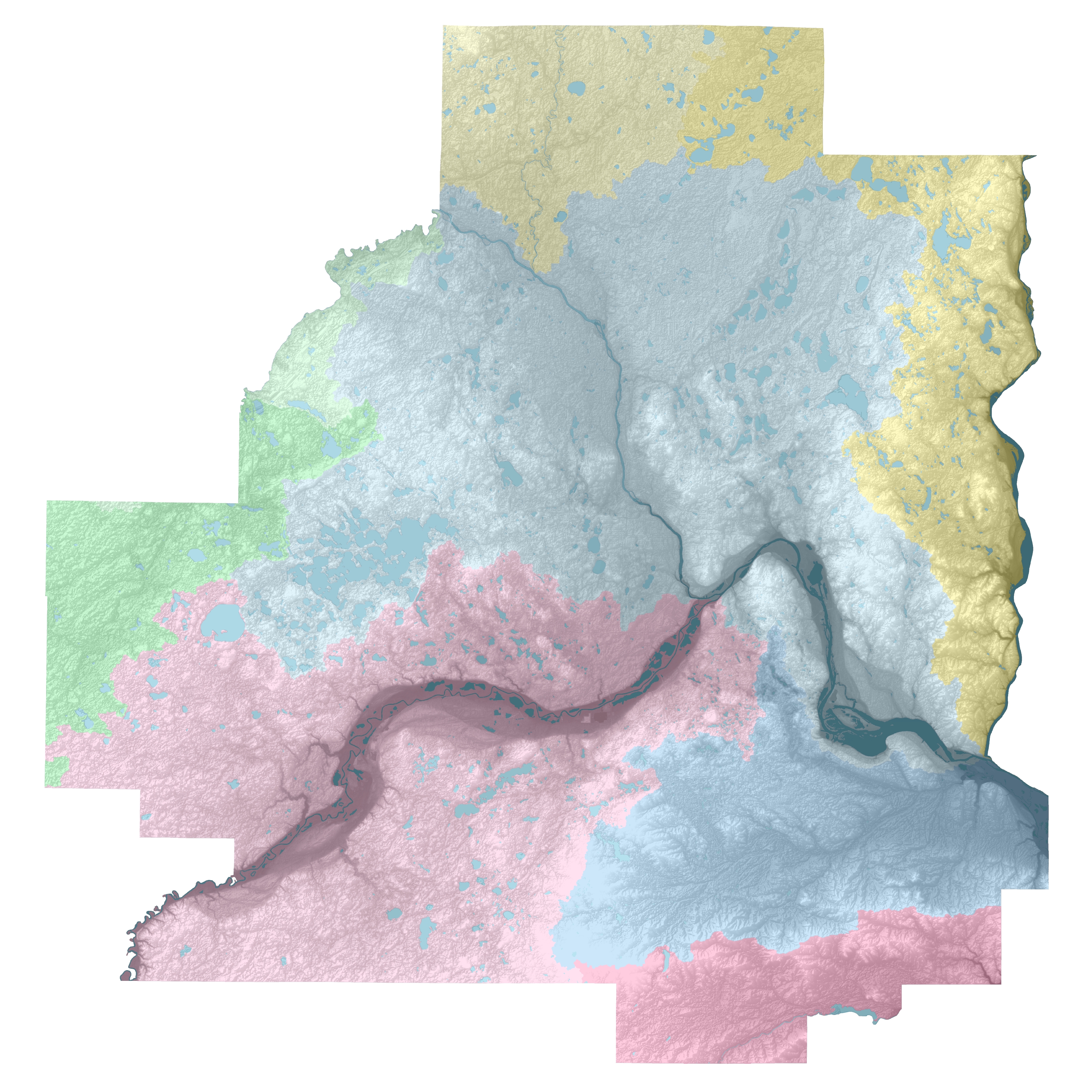
Brochure Building: Toson Hulstai Nature Preserve
In Fall 2017, I had the wonderful opportunity to study abroad in Mongolia. While living in the country’s capital, Ulaanbaatar, I worked as an intern for The Nature Conservancy. During my internship I created and updated GIS files, proofread conservation reports, and created a National Parks style brochure for TNC Mongolia’s anchor site.
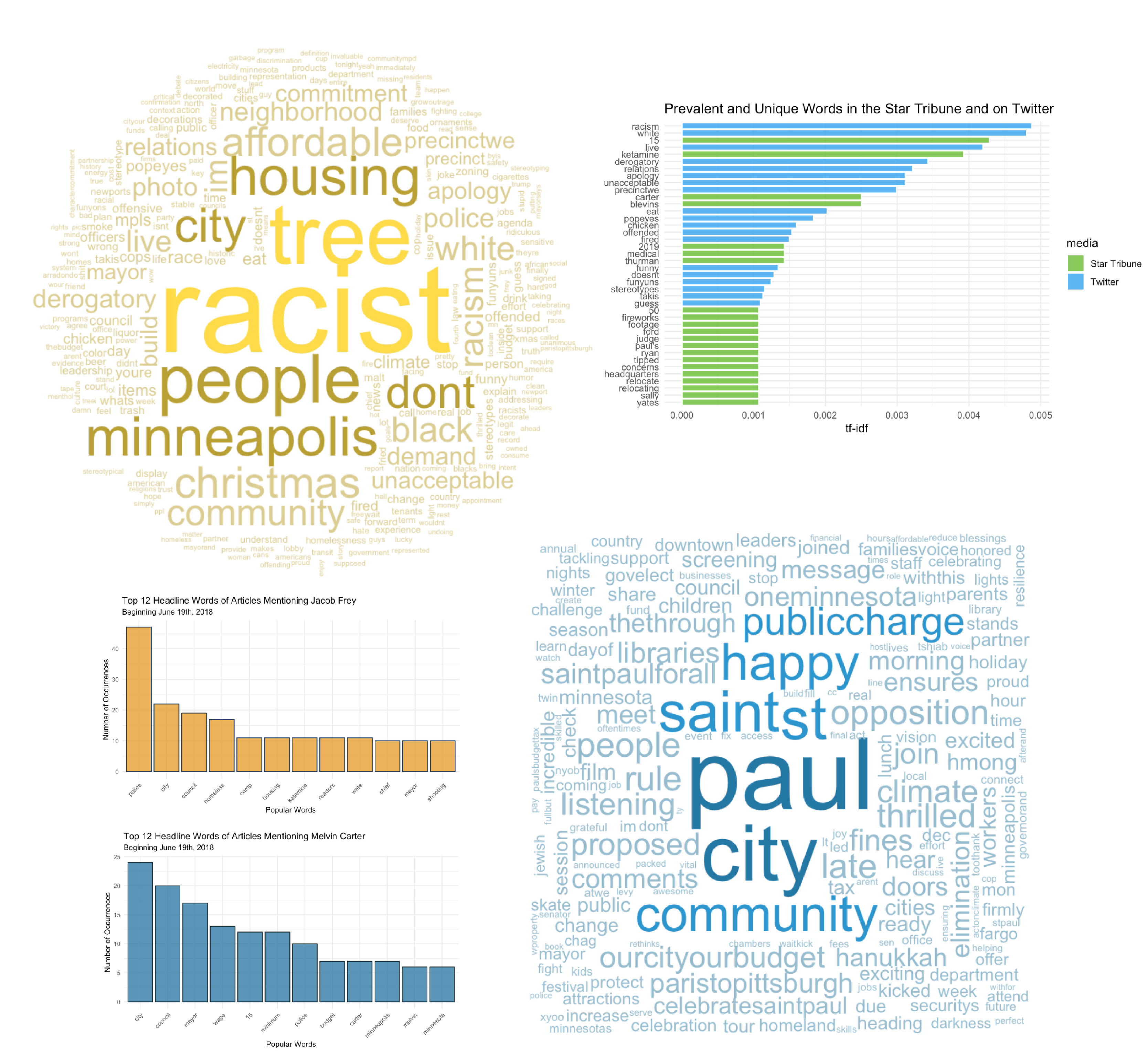
Getting Sentimental: An Analysis of Twin Cities Tweets and Headlines
As a final project for my Intro to Data Science course, I worked with four other students to analyze tweets and news headlines that mention Mayors Melvin Carter and Jacob Frey of St. Paul and Minneapolis, respectively. This was an exciting project that allowed me to expand my data wrangling and visualization skills using RStudio.
Cultural Atlas Production
In the spring of 2019 I was fortunate enough to be a teaching assistant (TA) for a fantastic class at Macalester College called Cultural Atlas Production.
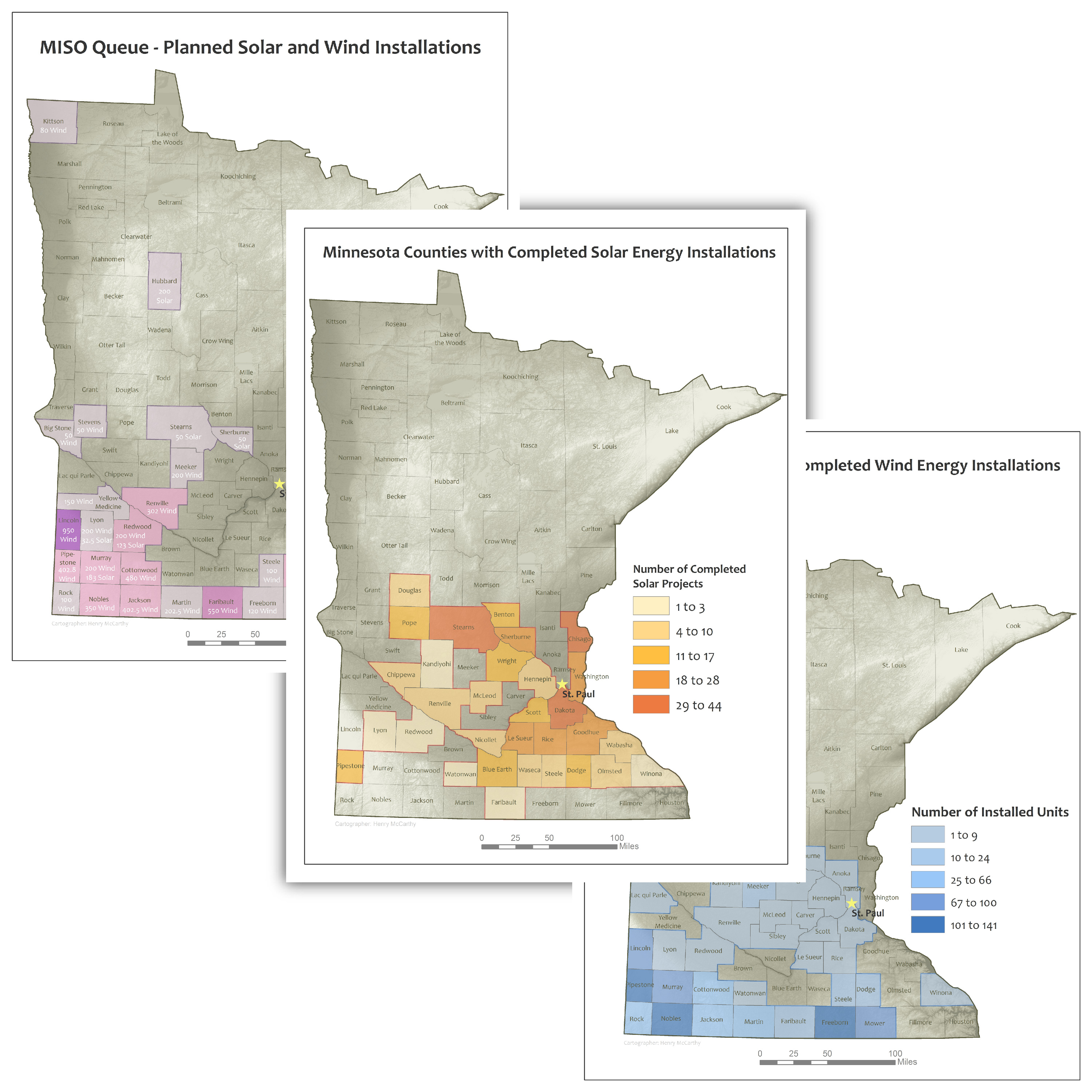
Water Supply Planning at the Met Council
Since June of 2019, I have been an intern in the Water Supply Planning unit of the Metropolitan Council of the Twin Cities.
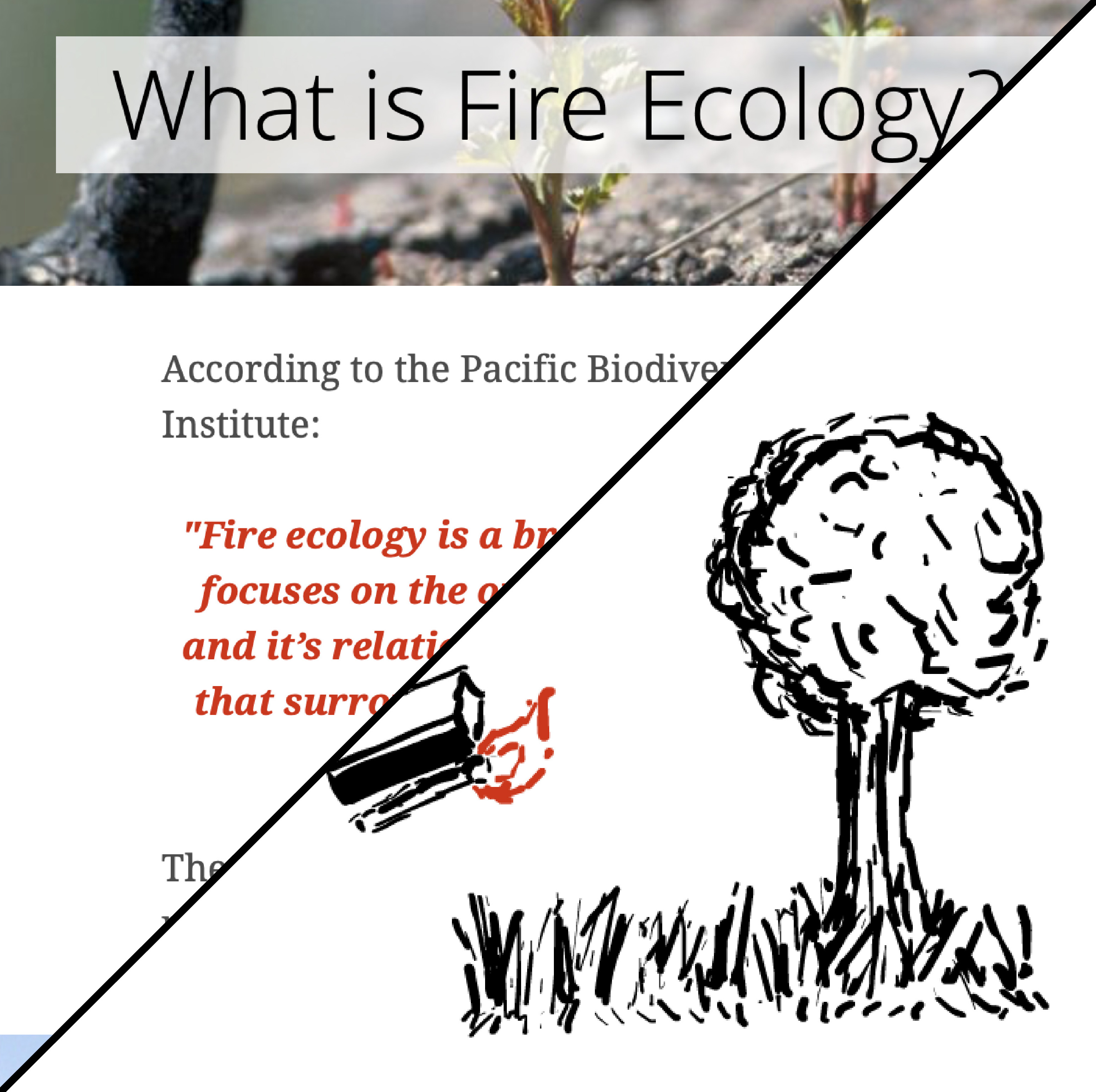
Brushing Up and Starting Fresh: Esri Story Maps, Adobe Animate, and Fire Ecology
One of my favorite classes at Macalester was Advanced Cartography and Geovisualization. For one of the assignments, I was tasked with creating a dynamic visualization using a new or somewhat unfamiliar platform. Interested in learning about animation in Adobe, I decided to create a series of short animations to illustrate concepts in fire ecology (a field that I have long been curious about but have not studied in detail). Wanting to stay up to date with Esri Story Maps, I decided to use this as a platform to host my animations.
Defining a Style
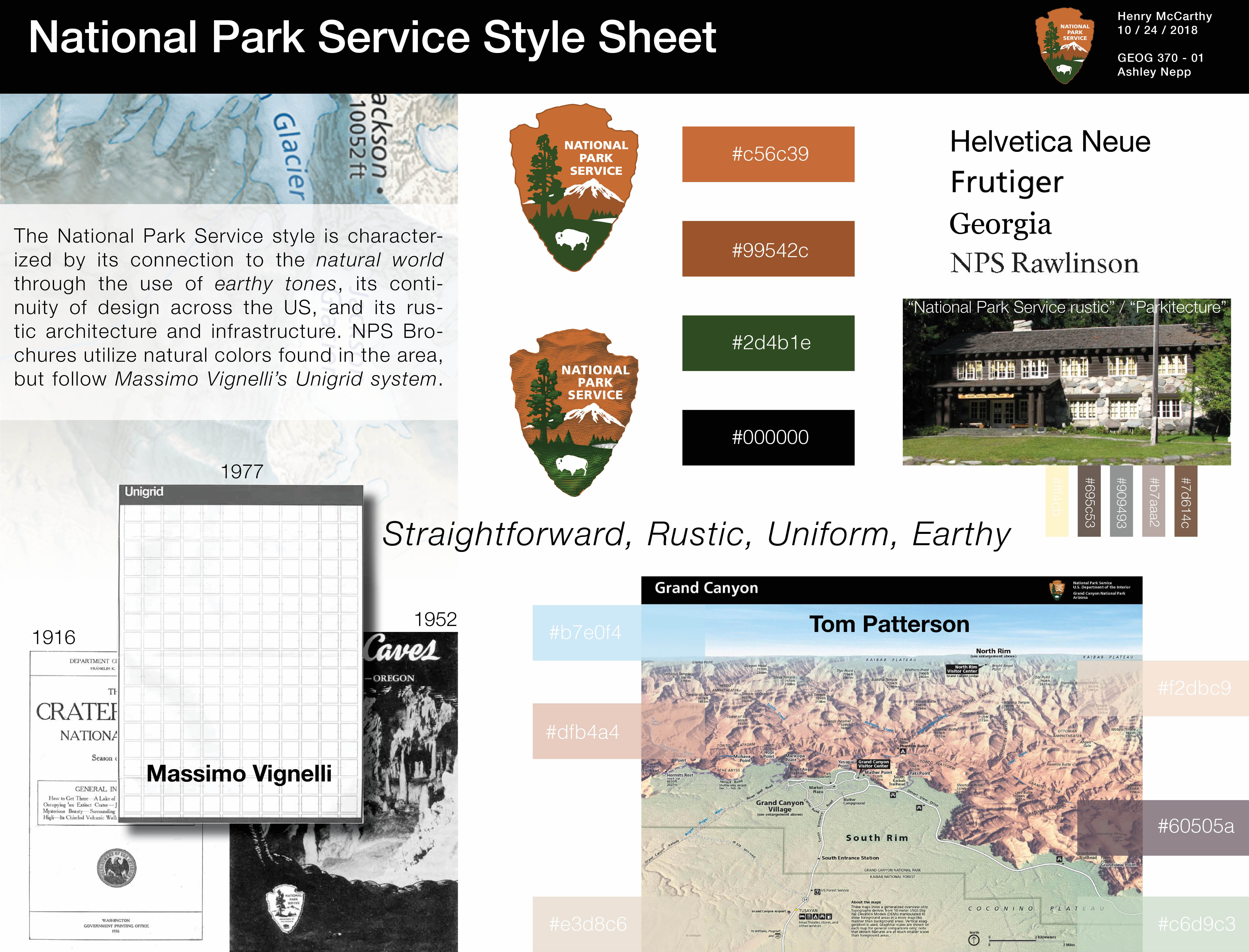
This was one of my favorite assignments from the Advanced Cartography and Geovisualization class I took in the fall of 2018. We were instructed to create a style sheet for just about anything, so having a bit of experience creating my TNC Mongolia brochure, I decided to further develop what I envisioned the National Parks “style” to be.
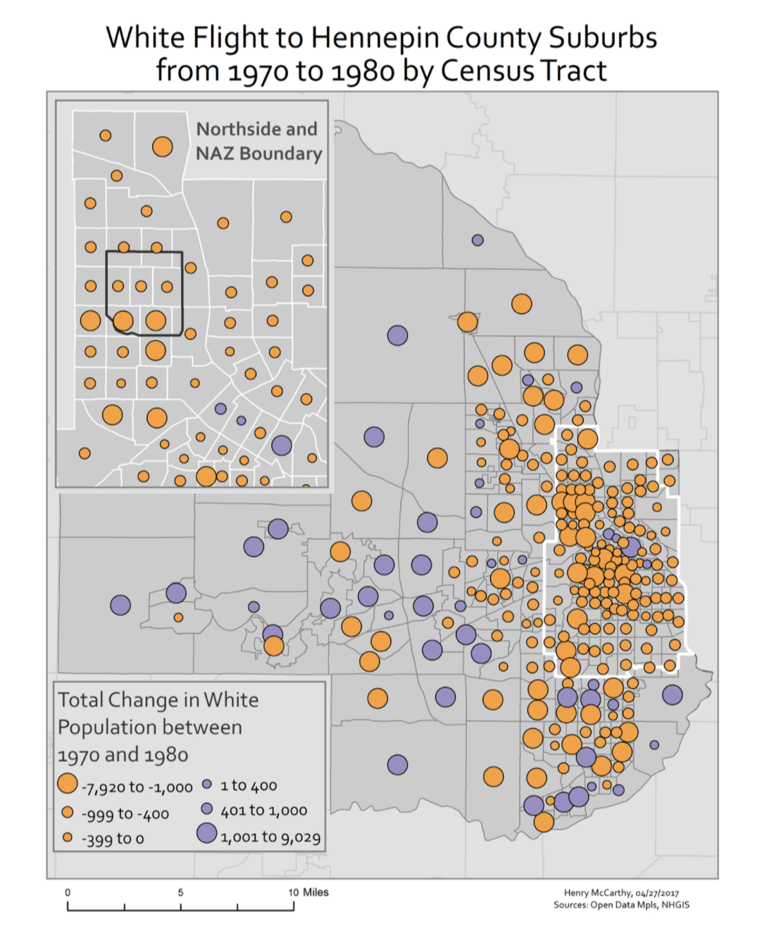
Urban GIS: Northside Achievement Zone
One of the most meaningful classes I took while at Macalester was Urban GIS. The semester that I took Urban GIS, our class partnered with the Northside Achievement Zone (NAZ) and produced a report to help inform decision-making and illustrate spatial trends in North Minneapolis.
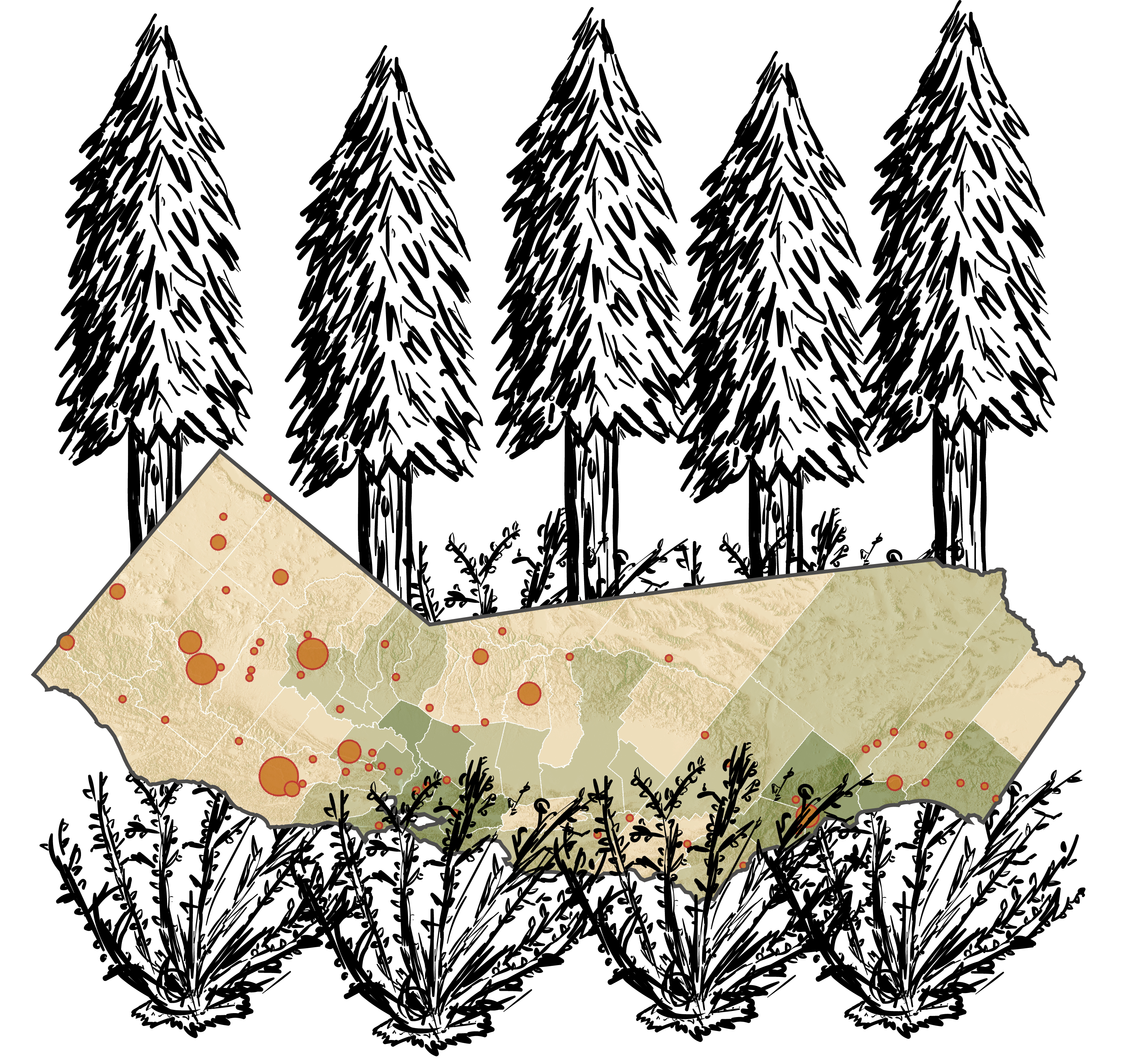
California on Fire: Continued Learning in Fire Ecology and Adobe InDesign
While in an Ecology class in the spring of 2019, I spearheaded the creation of an infographic for a group project on fire ecology. Using some sources that I was already familiar with from my fire ecology story map (such as the San Francisco Chronicle Wildfire Tracker), I was able to create a poster that offered additional information on fire ecology. To create the map, I took screenshots of the Chronicle’s Wildfire Tracker and then georeferenced the images in ArcMap to create point features for each fire.
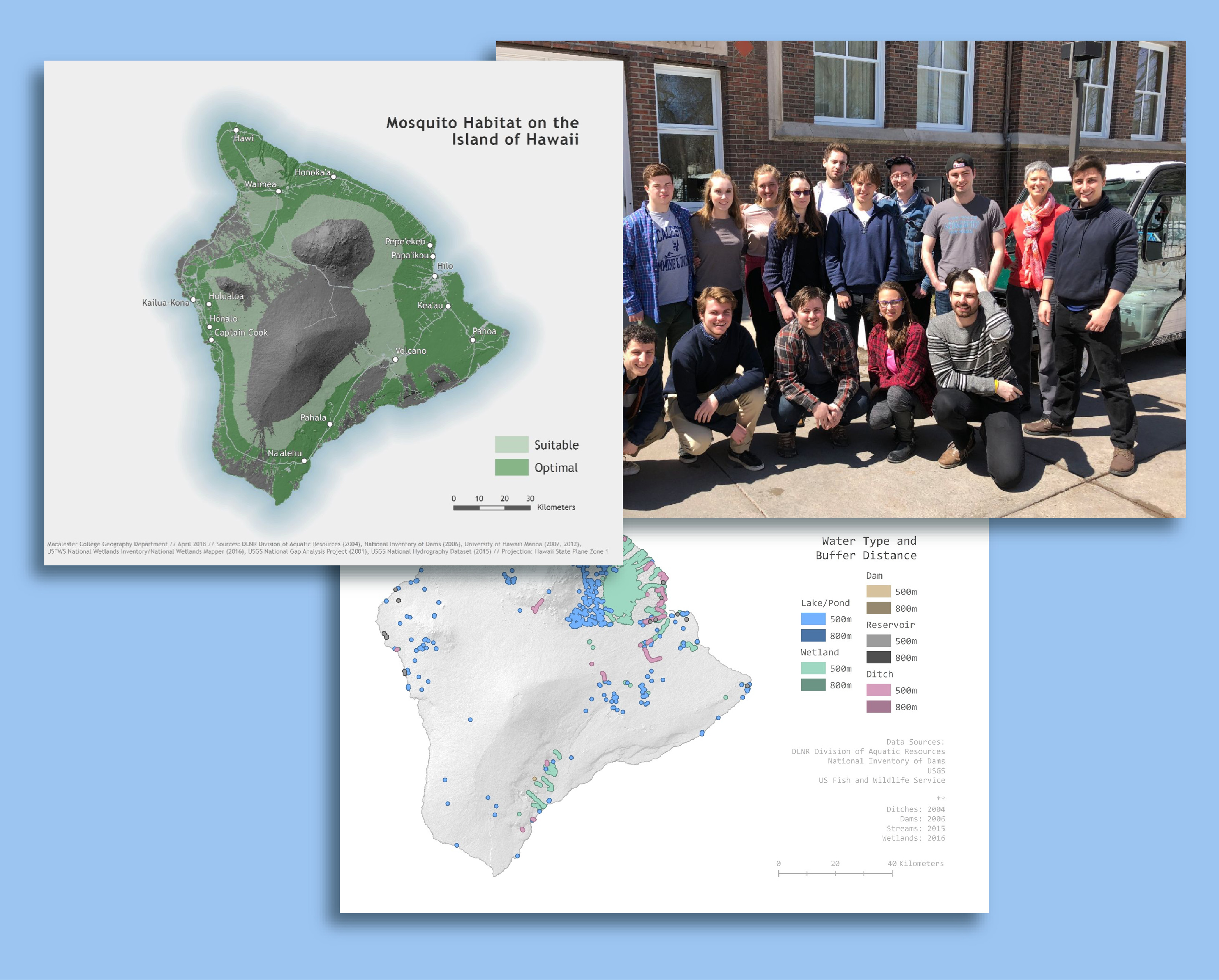
Dengue Risk Assessment on the Island of Hawaii
Macalester College / Advanced Geospatial Analysis / Spring 2018
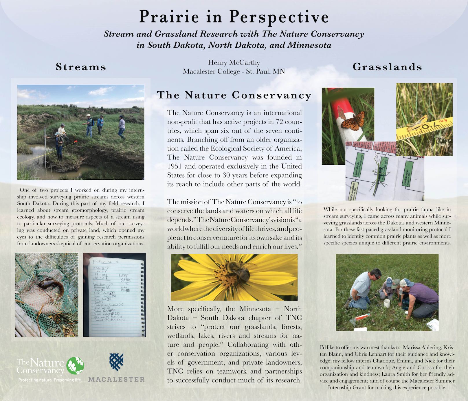
The Nature Conservancy - Grassland and Stream Surveys
In the summer of 2018 I had an exciting internship with The Nature Conservancy which allowed me to pursue my environmental and GIS interests while gaining valuable field experience. At the end of the summer, I wrote an essay reflecting on my time with the wonderful people at TNC Minnesota, North Dakota, South Dakota. This essay can be found below: – I first became interested in spending this summer with The Nature Conservancy while I was studying abroad in Mongolia during the fall semester of 2017.
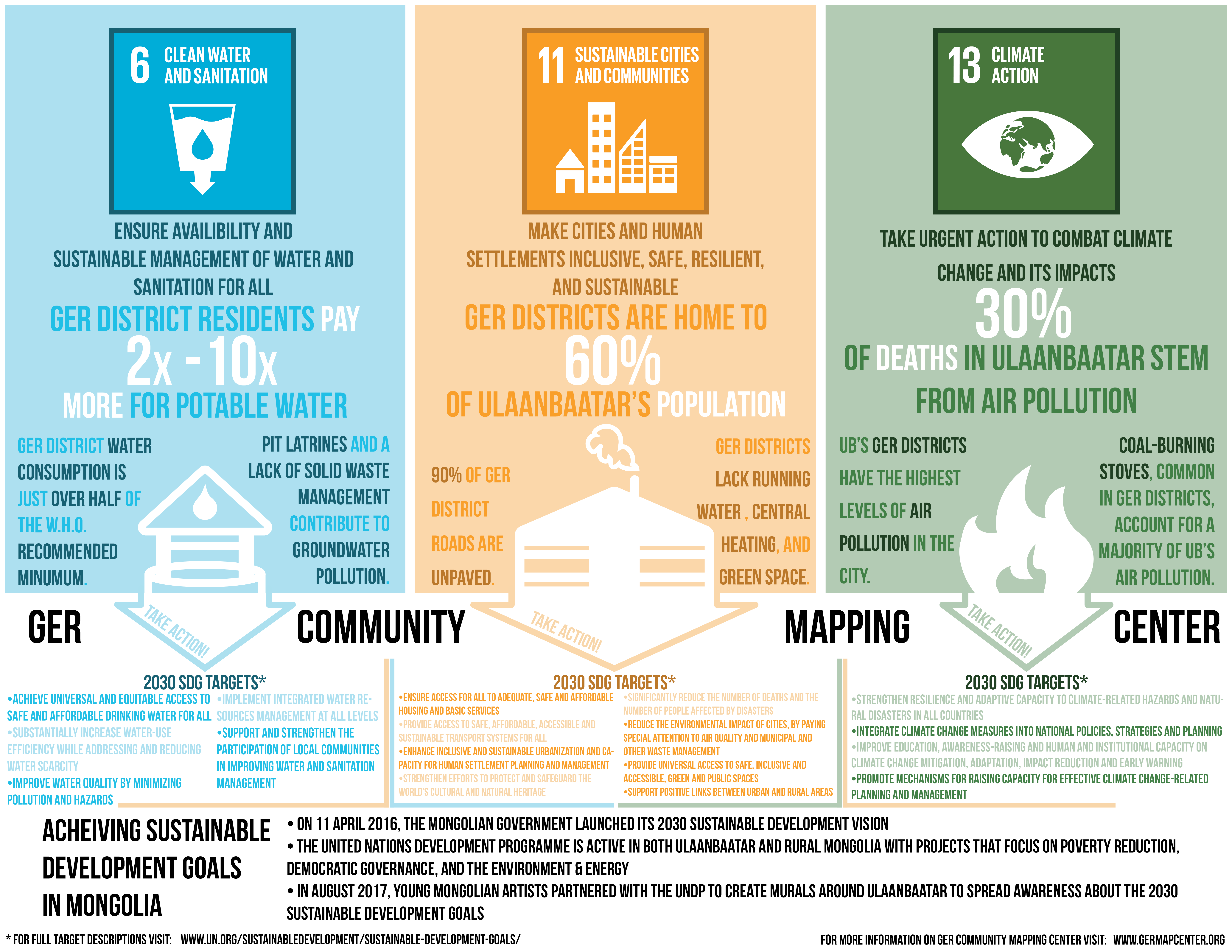
Sustainable Development Goals in Mongolia
While I was studying abroad in Mongolia I had the chance to complete a rapid-fire, three-day externship with a local non-profit called the Ger Community Mapping Center (GCMC). At GCMC I created an infographic highlighting UN Sustainable Development Goals as they pertain to Mongolia’s capital.
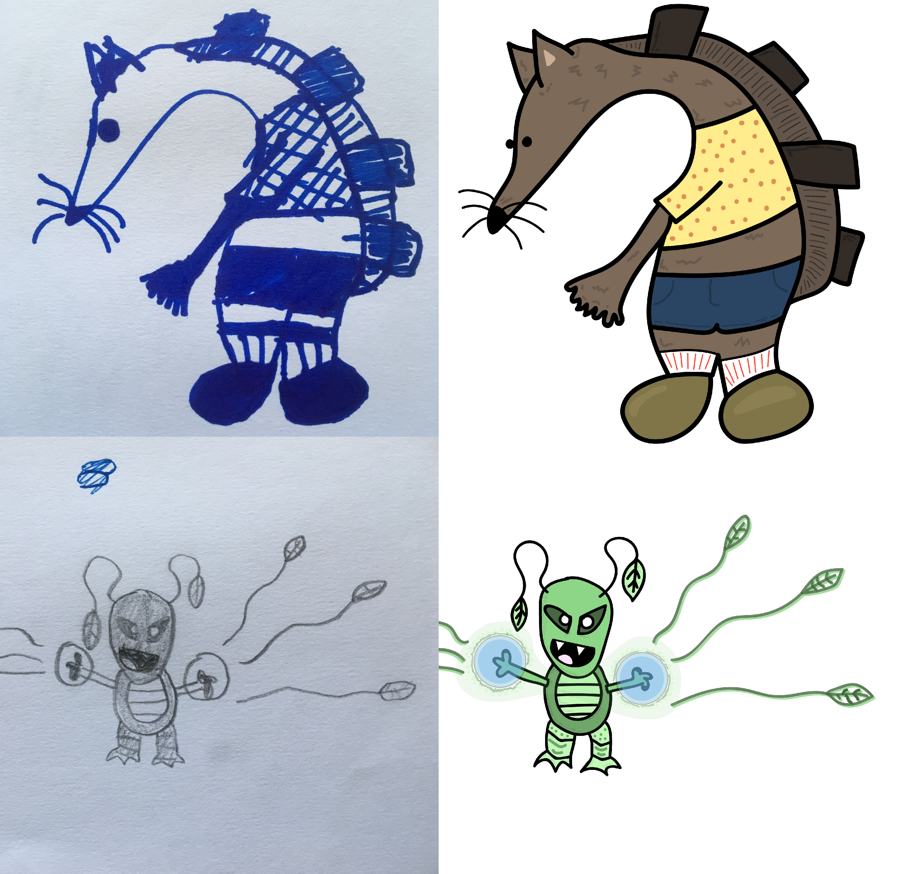
Doodles Revisited: Getting to Know the Wacom Intuos Graphics Tablet
This is a fun side project I’ve taken on as a way to familiarize myself with a Wacom graphics tablet. During a visit back to my family in San Diego, I came across some of my childhood sketchbooks and had the idea to recreate my doodles in Adobe Illustrator. I am a new owner of a graphics tablet and have been enjoying my time learning the tablet’s various capabilities.
Freelance
In addition to class projects and internships, I have done some work as a freelance cartographer and graphic designer. I am always eager to take on new projects so feel free to get in touch!
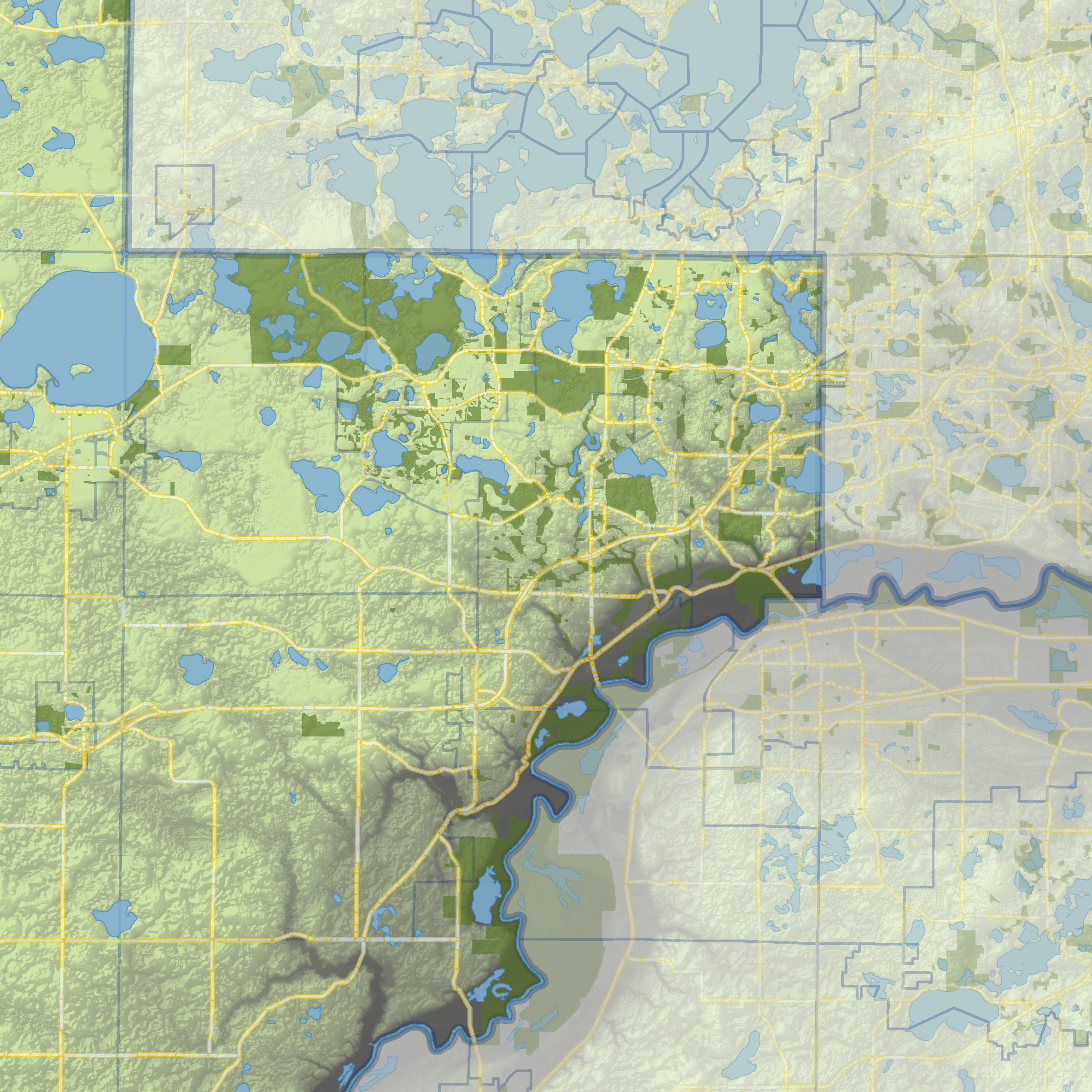
Work in Progress! Water Supply Field Guide
While at the Metropolitan Council of the Twin Cities, I’ve been working with one of my coworkers on an exciting project that introduces the public to water supply in the 7-county metro region.